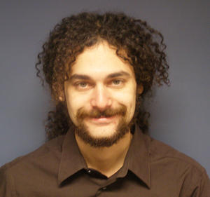
Through the Academic Initiative, Matthew Roe participated in an internship with NYCDOT, studying “Spatial Analysis and GIS Support for Sustainable Pedestrian Safety in New York City,” under the guidance of Seth Berman and Ann Marie Doherty. Matthew’s study was a GISdriven investigation into the geography of pedestrian safety, especially related to seniors, and the causes of pedestrian-vehicular crashes in New York City. Several major GIS tools and database-querying techniques were used for the analysis, including 1) spatial analysis, most usefully kernel-density analysis, which was used at the planning stages of the Safe Streets for Seniors project; 2) crash factor analysis and related investigations; and 3) enhancing data accessibility for project managers. Particular attention was paid to pedestrians over the age of 65, who comprise 40 percent of pedestrian deaths in New York City.
Matthew helped produce maps of the density of all senior pedestrian severe injuries and fatalities in New York City over a fiveyear period, which identified ‘hotspots’ with high concentrations of crashes, including several neighborhoods that had not previously been identified as problematic. While other techniques were applied to the senior pedestrian crash data, kernel density analysis provided the most consistent and applicable criteria, leading to the identification of twenty five high-priority areas for the Safe Streets for Seniors program. Five of these areas were investigated together with NYCDOT staff. This work and associated research laid the groundwork for broader pedestrian safety planning in New York City and helped to point the way to further research. Some of the resulting design treatments to address pedestrian safety include the installation of pedestrian refuge islands and neckdowns; leading pedestrian intervals for traffic signals; and (universally within the designated areas) pedestrian “Don’t Walk” clearance phases timed for a three-foot-per-second walking speed, the average for pedestrians over 65. As of 2011, improvements have been made at 13 of the 25 Safe Streets for Seniors locations.
Update
After graduation from Columbia University, Matthew Roe accepted a full-time position with NYCDOT as Planning and Research Manager in the agency’s Safety Office, where he continues to contribute to safety issues and needs, He is responsible for citywide safety planning, research, and data management, serving as project manager for the 2010 New York City Pedestrian Safety Study and Action Plan. His work also includes street design, project planning, and large-scale traffic monitoring, and he has managed two UTRC-funded studies undertaken on behalf of NYCDOT: “Pedestrian Fatality and Severe Injury Accidents in New York City;” and the “Effectiveness of Traffic Calming Measures.” In addition, his September 11th Memorial Program work was showcased in the June 2009 issue of UTC Spotlight, published by the University Transportation Centers Program within the Research and Innovative Technology Administration of the United States DOT.


